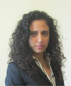
Dr Milto Miltiadou is a researcher of the Laboratory of Remote Sensing and Geo-Environment, Eratorshenes Research Centre, which is based at Cyprus University of Technology. From an early age, she showed exceptional performance and has been acknowledged with multiple awards. She studied her EngD at University of Bath, United Kingdom, with full studentship awarded by the Engineering and Physical Sciences Research Council (EPSRC) and specialised on efficient accumulation, analysis and visualisation of full-waveform (FW) LiDAR data in a volumetric representation with applications to forestry. During her EngD, she gained experience in both academia and industrial innovation through her placements at Airborne Research Facility of Plymouth Marine Laboratory, United Kingdom and Interpine Group Ltd, New Zealand. She further presented her research at eight well-established international and national conferences and she was invited to give lectures about FW LiDAR at the National Institute of Space Research (INPE), Brazil and University of Bari, Italy. Additionally, she has gained significant professional and life skills through extra-curricular activities, which include organising writing retreats and collecting feedback for improving student experience as the student representative.
For more information, please visit her personal website at: http://users.ntua.gr/miltomiltiadou
Supervisory and Advisory Board
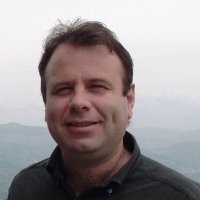
Prof Diofantos G. Hadjimitsis is the Vice Rector of Academic Affairs of the Cyprus University of Technology, Cyprus. He is a Professor at the Dep.of Civil Engineering and Geomatics and Head of the Remote Sensing and the Geo-Environment Lab. He is the Head of the ERATOSTHENES Research Centre.
Diofantos is a member of the Cyprus Scientific and Technical Chamber (ΕΤΕΚ). In the past, he has worked at the University of Surrey (UK), University of Southampton (UK), and Frederick University (Cyprus) as well in the industrial sector in the fields of remote sensing, geo-information and civil engineering. He has authored more than 300 research publications in peer-reviewed journals, conference proceedings, chapters in books and technical reports. His research group is the biggest group at the Cyprus University of Technology consisting 30 active researchers.
Since his appointment at the Cyprus University of Technology (2007), he participated in more than 60 research projects with funding sources from the Cyprus Research Promotion Foundation, FP6, FP7, Eureka, Life +, MED, EC, ERASMUS, HORIZON2020, regional funds, national funds and industry. Diofantos has been a coordinator of more than 15 research projects. He is a member of the ‘Advisory Committee’, which deals with national space issues under the umbrella of the Ministry of Communications and Works in Cyprus, for preparing the Cyprus join to European Space Agency as a full member. He is the member of the editorial team of the Central European Journal of Geosciences.
His research interests are: remote sensing, GIS, space applications, geo-information, geomatics, field spectroscopy, UAV, environmental applications, cultural heritage, sustainable construction etc.
Website: http://www.cyprusremotesensing.com/
Twitter: @excelsior2020eu
 Prof Ioannis Gitas is the head of the Forest Management and Remote Sensing Laboratory of Aristotle University of Thessaloniki, Greece. He specialises in Remote Sensing, GIS, Forest Fires and Environmental Monitoring. He is the author of more than 160 articles (journals, proceedings etc,), book chapters, monographs, books and reports. He has further supervised 39 MSc Theses and 7 PhD dissertations and he has been a member of PhD examination committees in Greece, Italy, Spain, Belgium and the UK.
Experienced Professor with a demonstrated history of working in the higher education industry. Skilled in ArcGIS, Sustainable Development, Lecturing, Biodiversity, and Environmental Awareness. Strong professional with a PhD CANTAB focused in GIS, Remote Sensing from University of Cambridge.
Website: http://fmrs.web.auth.gr/
 Dr Antoine Cottin is the chief technology officer at Carbomap Ltd, United Kingdom. He is an expert in bathymetric LiDAR processing. He did his PhD in Quebec and then a postdoc working in Mississippi with Optech and the US Army Corp of Engineers. He has over a decade of experience processing full waveform systems. Antoine has also led teams in successful field campaigns and has experience in the application and processing of terrestrial laser scanners.
Experienced Software Engineer with a demonstrated history of working in the renewables and environment industry. Strong engineering professional skilled in Software Development, C++, IDL/ENVI, Active and Passive Remote Sensing, LiDAR, Spatial Analysis, Global Positioning System (GPS) and Geographic Information Systems (GIS).
Website: http://carbomap.xyz/
Twitter: @Carbomap
 Friends of the Earth Cyprus (FoE Cy) is a non-profit, non-governmental, environmental organization, based in Limassol. The organization was established in 1980 and since then has campaigned on a number of local, national and international environmental issues. Their goal is to raise awareness on the importance of preserving the natural environment and to campaign for solutions to environmental and social problems by promoting sustainable policies. Friends of the Earth Cyprus is a member of Friends of the Earth Europe and Friends of the Earth International networks. They are also a member of the European Environmental Bureau (EEB), Zero Waste Europe network and the Federation of Environmental Organizations of Cyprus (NGO‟s). Currently they have approximately 400 members in the whole of Cyprus. Also, the section Young Friends of the Earth Cyprus, exists that is a group of young people concerned about their future and campaigning actively for it.
Website: http://www.foecyprus.org/
Twitter: @FoECyprus
Facebook Page: https://www.facebook.com/foecyprus/
