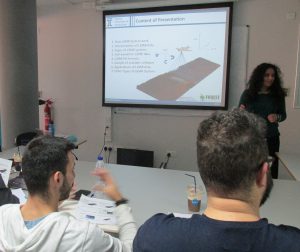
Yesterday, on the 13th of February 2018, Dr Milto Miltiadou held a workshop for the students currently taking the MSc Geoinformatics and Geospatial Technologies course at Cyprus University of technology. The workshop  was divided into three parts:
1. Introduction to LiDAR technologies; Dr Milto Miltiadou explained how LiDAR systems work, gave an overview of various algorithms developed for interpreting the data and extracting useful information, stressed the importance of full-waveform LiDAR data (which is the main focus of the “FOREST” project), gave an overview of available tools/software and outlined various applications, e.g. biodiversity, forest health monitoring and wood trade.
2. The invited speaker from the industry, Dr Antoine Cottin, presented the state-of-art sensors and the recent advancements in the LiDAR instruments developed by Riegl.
3. At the end of the workshop, there was a practical session on DASOS with hands-on training on how to interpret the data and extracting elevation and other maps.
After discussion, students’ feedback was really positive and seemed excited about LiDAR technologies and their capabilities in collecting detailed structural information.

Leave a Reply